EO4SA aims to develop innovative EO high-level products and indicators for supporting the sustainable development, regulation and management of aquaculture farming in coastal and offshore waters. The project will centre on four Use Cases, where we will work closely with Early Adopters - the key stakeholders who plan to make use of, and benefit from the project outcomes.
1. Predicting risks of salmon lice infestation in Norway
2. Forecasting Toxic Algal Blooms (HABs) impacting shellfish farming in Norway
3. Optimising the location of sustainable shellfish farming and tourism in Galicia, Spain
4. Mapping aquaculture structures and use of marine resources in Palawan, Philippines
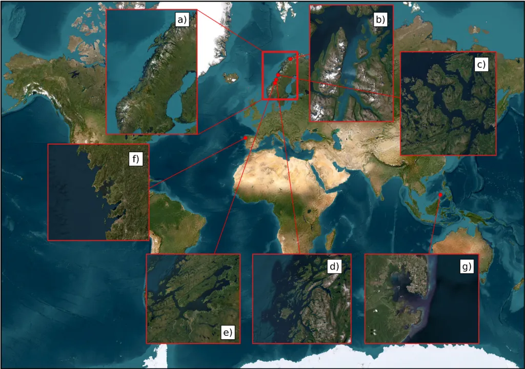
Specific locations of the Use Cases:
Predicting risks of salmon rice infestation in Norway
a) Norwegian coastal and offshore waters
Forecasting Toxic Algal Blooms (HABs) Impacting Shellfish Farming in Norway
b) Lyngen fjord, c) Namsen fjord, d) Helgeland, and e) Fosen
Optimising the Location of Sustainable Shellfish Farming and Tourism in Galicia, Spain
f) Galician rias of NW Spain
Mapping Aquaculture Structures and Use of Marine Resources in Palawan, Philippines
g) Puerto Princesa Bay, Palawan, Philippines
Type / to request AI content
Project Overview
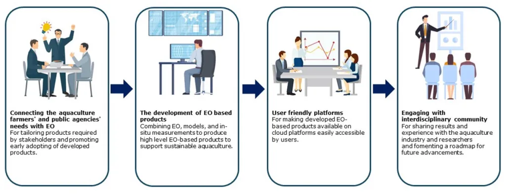
Participative engagement of both the researchers and the main stakeholders in the aquaculture industry is essential for a successful project. We plan to achieve this by a series of meetings and discussions with the Early Adopters involved.
Connecting the aquaculture farmers' and public agencies' needs with EO is an important first step of our work. The aquaculture industry is regulated by the national authorities and the industry must be compliant with local regulations in order to obtain and maintain their licences for operations. Adaptation to new information (to be developed in the EO4SA project) in well-regulated systems requires early involvement of both authorities, research institutions and industry to obtain acceptance. Besides, new information needs to be tailored to the regulatory framework and stakeholders needs. Hence, we have included the public and private stakeholders as the Early Adopters during the beginning of the project to shape the development of products and services, such as establishing the standards for data format, spatial resolution, and temporal frequency, considering their information needs but also the EO limitations.
The development of EO based products will be achieved in four Use Cases by employing models that use EO data as input, some models exist already, and others will be developed, tailored to the project needs. Developed algorithms will be documented and provided as open source, following the Findable, Accessible, Interoperable, and Reproducible (FAIR) principles.
User friendly platforms will be used to implement and disseminate the developed EO-based products and make them accessible to the Early Adopters. The cloud platforms run by the two project partners, NARVAL and PRIMUS, will be used to make geographical and temporal data and products available. The Early Adopters will be taught how to use the platforms and assess the information products. Validation of the operational use and feedback on the usefulness of the service/products for their daily operations will be analysed.
Engaging with the wider scientific and aquaculture communities will take place, with the project results being disseminated through various platforms, including this website and dedicated sessions at international conferences. The project commits to deliver two scientific publications related to the EO4SA products and their validation from at least two of the four proposed Use Cases, with further publications also possible.