Sustainable Aquaculture Use Cases
EO4SA will concentrate on four Use Cases, through which we aim to improve the use of Earth Observation data in the sustainable aquaculture sector. Each Use Case has a number of Early Adopters - key stakeholders such as government departments, businesses, NGOs, etc. who will help both define the products and services offered, and test and validate them. The aim is to better integrate Earth Observation data into the daily operations of the Early Adopters, whether they are a large seafood company or a local governmental office.
Salmon Lice Infestations in Farmed Fish
We aim to help both the Norwegian authorities and industry build a better knowledge base for the justification and enforcement of the "traffic light system" for regulating the production capacity of farmed Atlantic salmon.
Harmful Algal Bloom Impact on Shellfish
EO data can track environmental conditions around algal growth, as well as improve Harmful Agal Bloom forecasts. We will use EO data to make sub-seasonal forecasts available to Norwegian farmers to help avoid shellfish loss.
Multiple Uses of Marine Coastal Areas
In the Galician Rias of NW Spain, the coastal areas are in high demand for both shellfish farming and tourism. We aim to use EO data to optimise aquaculture production, thereby allocating more space to other coastal activities.
Mapping Aquaculture Development
EO based mapping of aquaculture infrastructure around Puerto Princesa City can enable the authorities to manage the marine resources of Palawan, Philippines to better balance livelihoods and protect the environment.
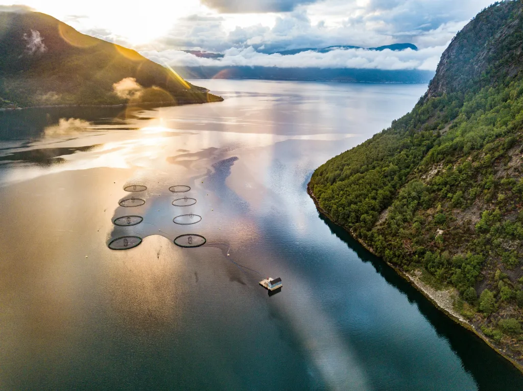
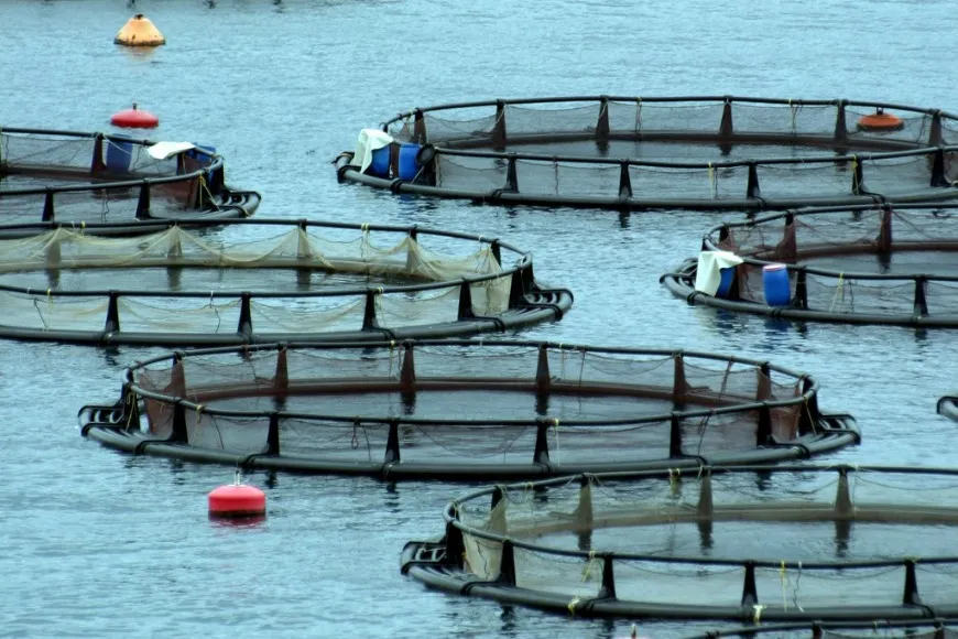
Predicting Risks of Salmon Lice Infestation in Norway
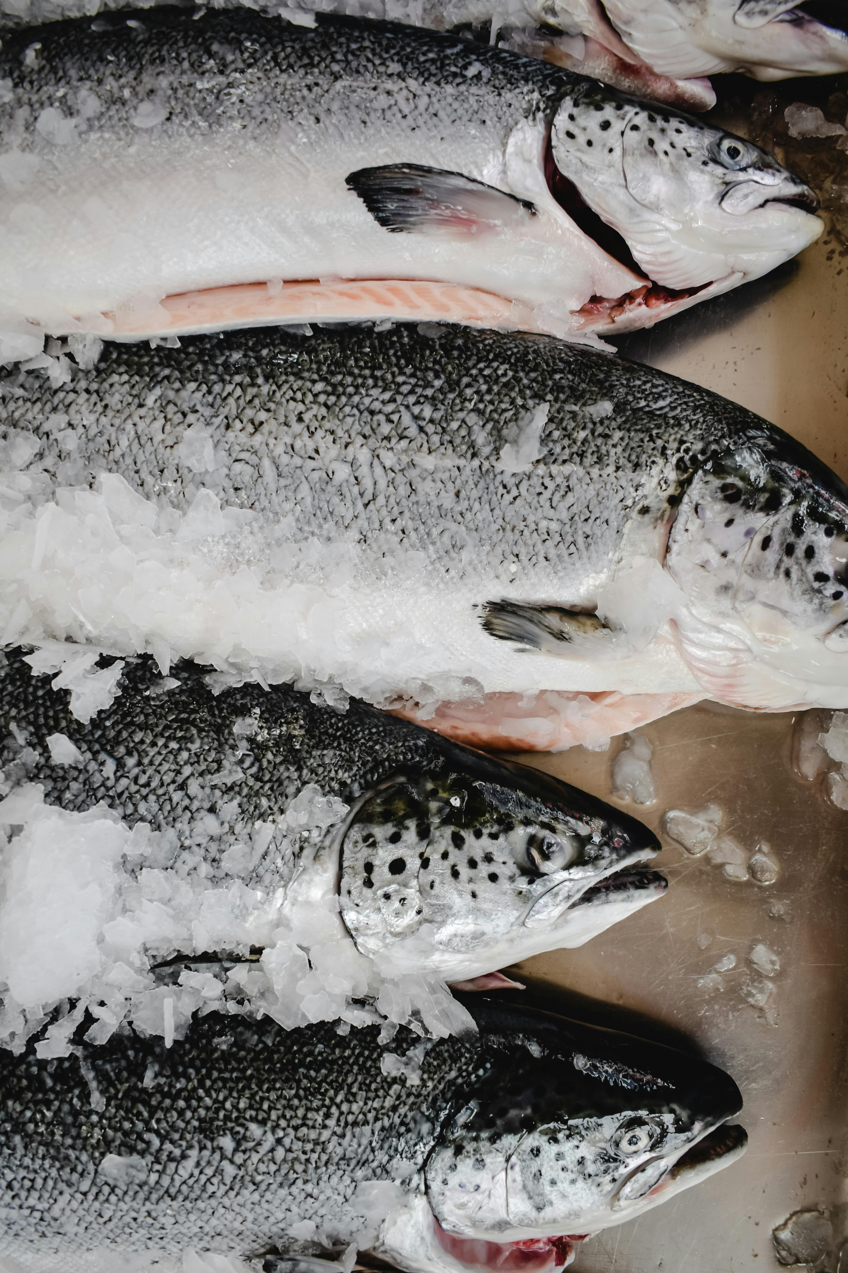
Salmon lice are a big problem for Norwegian aquaculture, causing superficial damage and promoting the spread of several diseases, usually causing death. Even though Norway has measures to mitigate the spread of the lice, the annual mortality of farmed fish has reached up to 25% in 2023, of which mostly are directly (physical damage) or indirectly (spread of diseases and delouse methods) related to salmon lice. For the aquaculture industry these losses are difficult to quantify exactly, but in Norway the news-reported losses are about 5 billion NOK due to salmon lice and other diseases. In addition, the annual mortality estimations of wild salmon have reached more than 30% due to salmon lice infection in some regions, which is likely facilitated by the high-density aquaculture environment.
In Norway, for management of the coastal waters, a ”traffic light system” is implemented by the Norwegian government via the Fisheries and Oceans Ministry, where salmon farming is regulated (capacity adjustments of licences and expansion or reductions of fish volumes) based on the mortality of wild salmon due to the lice. EO4SA aims to help both the authorities and industry build a better knowledge base for the justification and enforcement of these regulations.
Salmon lice are substantially impacted by in-water environmental conditions, such as temperature, salinity, surface winds and surface currents. Such environmental conditions are estimated by EO on large scales and have the potential to be used as predictors in models of salmon lice infection risk. This could enhance the current mitigation strategies (e.g. protective barriers or de-lice technologies and/or medication). Risk assessment, through observations and forecasts, could empower farmers and authorities in decision-making to reduce fish mortality and marine pollution. Such information could be also essential for managing the aquaculture locations, their density, and production capacity e.g., as one of the major conditions for the national regulatory “Traffic light” system for regulation fish densities in each farm and the number of farms within each of the 13 national production area.
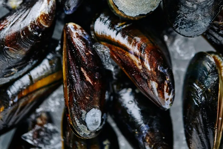
Forecasting Harmful Algal Blooms (HABs) Impacting Shellfish Farming in Norway
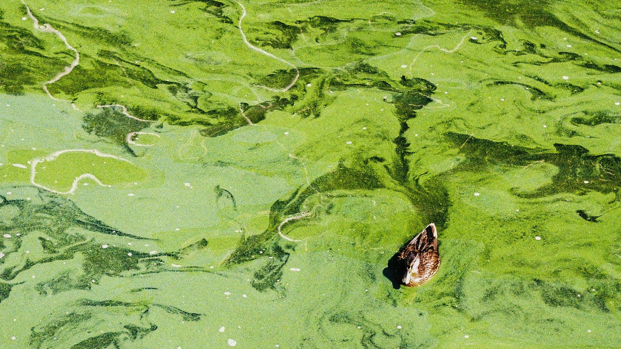
Some algal blooms produce toxins, which can be harmful to people, fish, shellfish, marine mammals and birds when their abundance rapidly grows. These Harmful Algal Bloom (HAB) events have been one of the significant factors related to the decline of shellfish production in Europe, which saw a 20% decrease from 1990 to 2016. Once shellfish are contaminated with toxins from HABs, they can remain poisonous for long periods, leading to substantial revenue losses for farmers. This issue is further exacerbated when farmers spend money to purify the shellfish of the toxins, a process known as depuration, but the depurated shellfish, post-HAB, do not align with market demands and remain unsold.
In Norway, the fish farming industry has significantly expanded over the last 30 years, while shellfish farming production has remained relatively unchanged. In addition to domestic market demands, HABs have been identified as one of the main reasons for this stagnation and why some shellfish farmers go bankrupt within their first few years of operation in the region. Shellfish farming is a low trophic level and sustainable practice with a low CO2 footprint. Therefore, there is a strong interest in expanding shellfish farming and developing more sustainable operations in supplying the commercial consumption and market.
Natural algae growth is controlled by several environmental conditions, such as sea surface temperature, salinity, photosynthetically active radiation, and mixed layer depth, of which many parameters are obtainable through EO data. Therefore, EO data can also be used as input for HAB forecast models. Making sub-seasonal HAB forecasts available to Norwegian shellfish farms has the potential to empower them with tools to reduce revenue loss. For example, they could harvest shellfish prior to contamination and better plan seasonal supply to the market based on the risk of HABs. Consequently, such improvements could aid the development of shellfish farming in Europe.
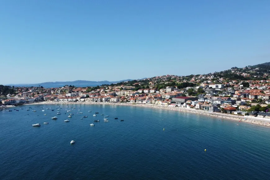
Optimising the Location of Sustainable Shellfish Farming and Tourism in Galicia, Spain
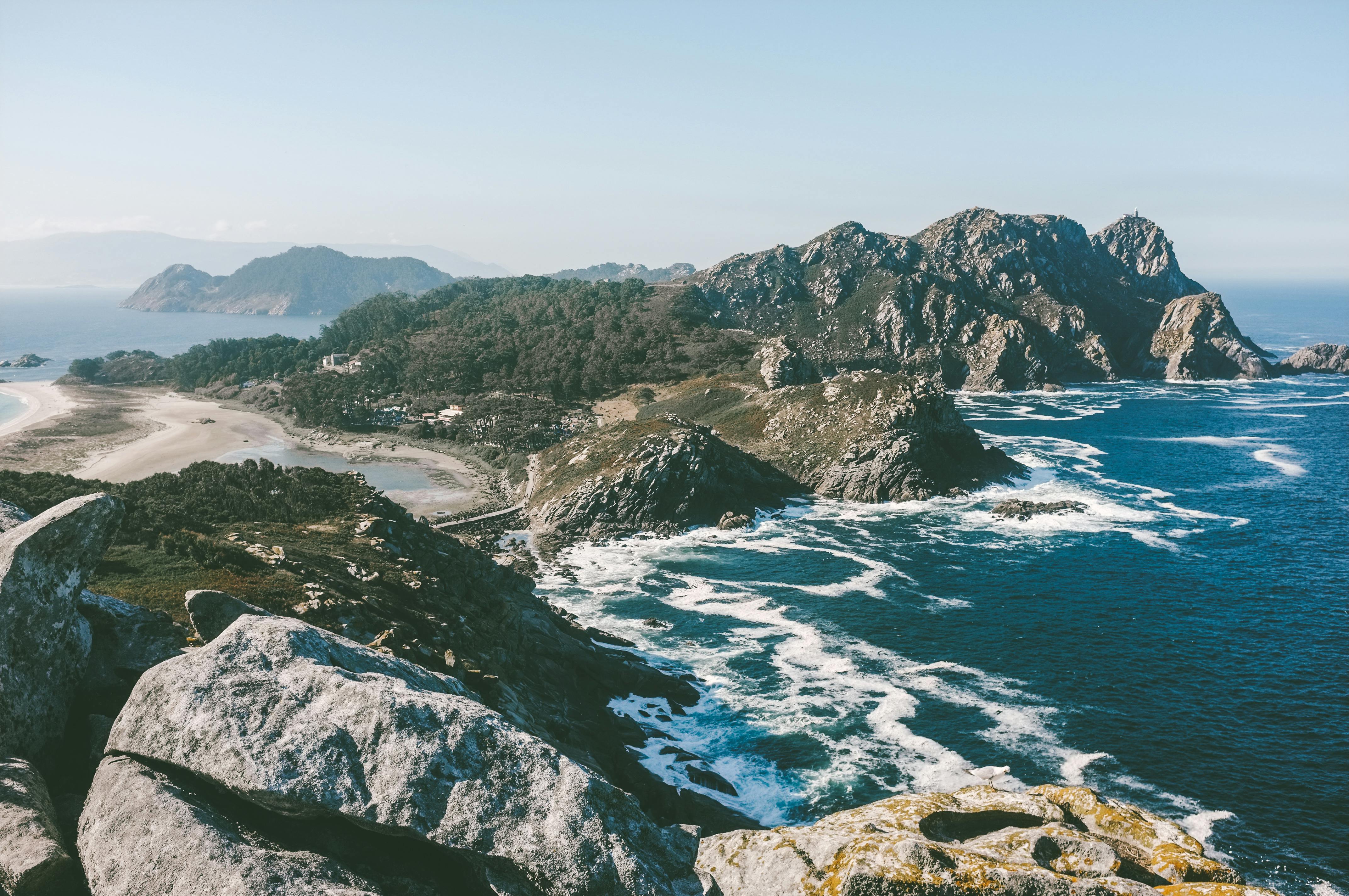
In the Galician Rias, north-west Spain, there are multiple users of the coastal areas. Maritime traffic, recreation, tourism, and nature conservation compete for space with small-scale fisheries, shellfish extraction from sandbanks and large-scale mussel aquaculture. The latter of which represents 40% of the European production of mussels. These conflicts can be mitigated by optimizing shellfish operations, such as concentrating farming activities in areas where mussels can grow well, while regulating the maximum farming an area can sustain in terms of natural primary production, in order to allocate more space to other coastal activities.
The growth of shellfish depends on the natural food availability and quality, such as the amount of net primary production (NPP) and suspended particulate matter (SPM). While phytoplankton NPP can improve shellfish development, high concentrations of inedible SPM reduce their growth. Food availability and food quality are therefore key inputs for the Dynamic Energy Budget (DEB) models used for modelling mussel growth. Chl-a concentration and the ratio of particulate organic carbon (POC) to SPM have been revealed as suitable proxies for food availability and quality, respectively, and are available as high-resolution satellite products. Together with sea surface temperature and solar irradiation (used to compute NPP estimates), these can improve the modelling of mussel growth, which can be used to test strategies to optimise aquaculture production.
In addition, overexploited areas can reduce NPP available to the local ecosystem. The monitoring of Chlorophyll-a concentration can be used for estimating the NPP and the regional carrying capacity. Previously this has been done using Sentinel-3 OLCI but higher-resolution requirements have been a demand from stakeholders in the region, including farmer associations and representatives from local monitoring bodies. Although not its intended purpose, Sentinel-2 MSI observes ocean spectral reflectance at spatial resolutions between 10m and 60m and its potential for meeting these requirements will be explored in the project.
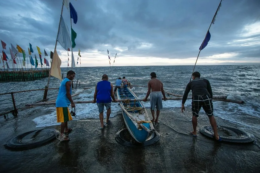
Mapping Aquaculture Structures and Use of Marine Resources in Palawan, Philippines
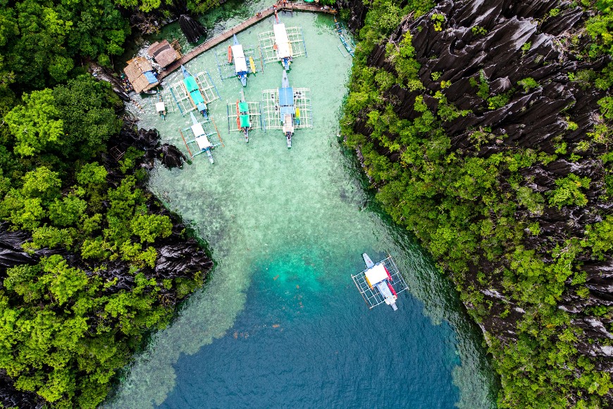
In Palawan, Philippines, coastal aquaculture is gaining momentum towards increasing fish production, a pressure that presents a challenge to the sustainability of these areas. Puerto Princesa City, Palawan, is known as the "Eco-Tourism Center of the Philippines" with many beach resorts and seafood restaurants. It has been recognised as the cleanest and greenest city in the Philippines and supporting sustainable use of ocean resources is one of the key priorities for the local government. There are three major bays in this area. Honday Bay is known as a tourist site in Palawan, particularly for island hopping activities. It is also known as one of the main fishing grounds in Puerto Princessa City. Puerto Princesa Bay is an aquaculture site where oysters, green mussels, seaweed, and fish cage culture are established. Uluga Bay is also a fishing area, and the majority of the locals rely on the bay for their livelihood.
Sustainable development of the blue economy in Puerto Princessa City is a challenging task due to the amount and variability of marine activities. It requires accurate planning from the local government and regulation of the use of marine resources. Environmental monitoring that can help with this includes mapping the locations of aquaculture sites and the spatial distribution of fish cages, floating houses, and longline buoys, among others depending on the aquaculture type. While these assessments are commonly documented in regions like Europe, places such as Palawan face challenges in monitoring aquaculture infrastructure. EO based mapping of aquaculture infrastructure will benefit Puerto Princesa City local government unit, and other agencies, such as the Bureau of Fisheries and Aquatic Resources (BFAR)-Province and MIMAROPA Region. The EO data will help them to manage the resources of Palawan, to balance their livelihood programs and to protect the environment.
This project will use both multi-spectral optical and microwave synthetic aperture radar (SAR) sensors for the monitoring. In particular, SAR shows the advantage of providing information even through cloud-covered scenes day and night. The satellite detection of aquaculture infrastructure can therefore support the control, density, and proliferation of aquaculture activities and ensure sustainable exploitation of marine resources while minimizing the environmental impact.